
Laser Scanning Surveys
Detailed Point Clouds, Reliable Results
Get a Free Quote From Us Today!
We aim to get back to you in 24 hours.
At Laser Scanning Surveys, we specialise in providing professional laser scanning services for existing buildings and intricate environments throughout the UK. Our expertise lies in capturing precise 3D data swiftly, supporting measured surveys, BIM modelling, refurbishment projects and construction planning. With advanced laser technology, we deliver high-quality results to meet the diverse needs of architects, engineers, and construction professionals.
Contact us to discover how our services can assist your next project.
Who Is Laser Scanning Surveys?
At Laser Scanning Surveys, we offer comprehensive laser scanning services across the UK, specialising in capturing precise data for existing structures and complex environments. Our modern equipment, including the latest high-definition 3D laser scanners, produces detailed 3D models, essential for accurate planning and assessment in various projects.
We cater to a diverse array of clients, from architects and engineers to construction firms and heritage conservation specialists. Our services are ideal for projects requiring precise measurement and documentation, such as BIM (Building Information Modelling), topographic surveys, and volumetric calculations.
Our team stays ahead of industry standards like PAS 1192 for BIM, ensuring that our deliverables are compatible with the latest software for easy integration. With typical completion times ranging from a few days to a few weeks depending on project size, we provide efficient and reliable results.
Contact us today to learn how we can assist with your next project.
What Services Does the company Laser Scanning Surveys Provide?
Our team delivers a wide range of services tailored to your project needs, using industry-leading technology and methodologies to provide valuable insights and data for various applications.
- 3D Laser Scanning: Capturing thorough and accurate 3D data of existing buildings and complex environments with technologies such as LiDAR (Light Detection and Ranging). Our laser scanners can cover expansive areas and capture millions of data points within short timeframes, ensuring precision for heritage sites, industrial facilities, and commercial developments.
- Measured Surveys: Providing detailed measurements to support refurbishment and construction planning. We use total stations and GPS equipment to gather precise data, adhering to RICS standards that guarantee quality and reliability. Our surveys assist in the preparation of floor plans, elevations, and section views.
- BIM Modelling Support: Facilitating the integration of scanned data into Building Information Modelling for enhanced project management. Our team seamlessly converts point cloud data into 3D BIM models, enabling architects and engineers to simulate project scenarios and improve decision-making processes.
- Construction Planning Assistance: Using precise data to ensure efficient and effective planning processes. We provide accurate foundation and structural assessments, crucial for securing planning permissions and developing method statements, thus reducing construction risks and delays.
Choose us to support your projects with accurate data and the latest technology.
When Is Laser Scanning Needed?
You typically need laser scanning when embarking on refurbishment or reconstruction projects that require accurate data of existing conditions. Laser scanning is beneficial for precision measurements, capturing intricate details that traditional surveying methods may miss.
It is applicable when documenting historical buildings where preserving intricate architectural features is crucial. Our laser scanning technology helps generate comprehensive BIM (Building Information Modelling) models, aiding architects and engineers in detailed planning and reducing potential design conflicts.
Additionally, laser scanning supports the successful planning of complex construction developments by offering a full 3D view of the project site. This approach allows us to detect clashes or design flaws before construction begins, streamlining the construction process.
This service is ideal for clients such as architects, civil engineers, and construction firms involved in large-scale projects. By incorporating laser scanning, we aim to save time and reduce errors along the way.
How Does Laser Scanning Surveys Work?
Here’s how we deliver our laser scanning services:
- Initial Consultation: Discuss the project requirements and scope, focusing on specific objectives such as accuracy needs and integration with existing designs or technologies, like BIM systems or CAD software.
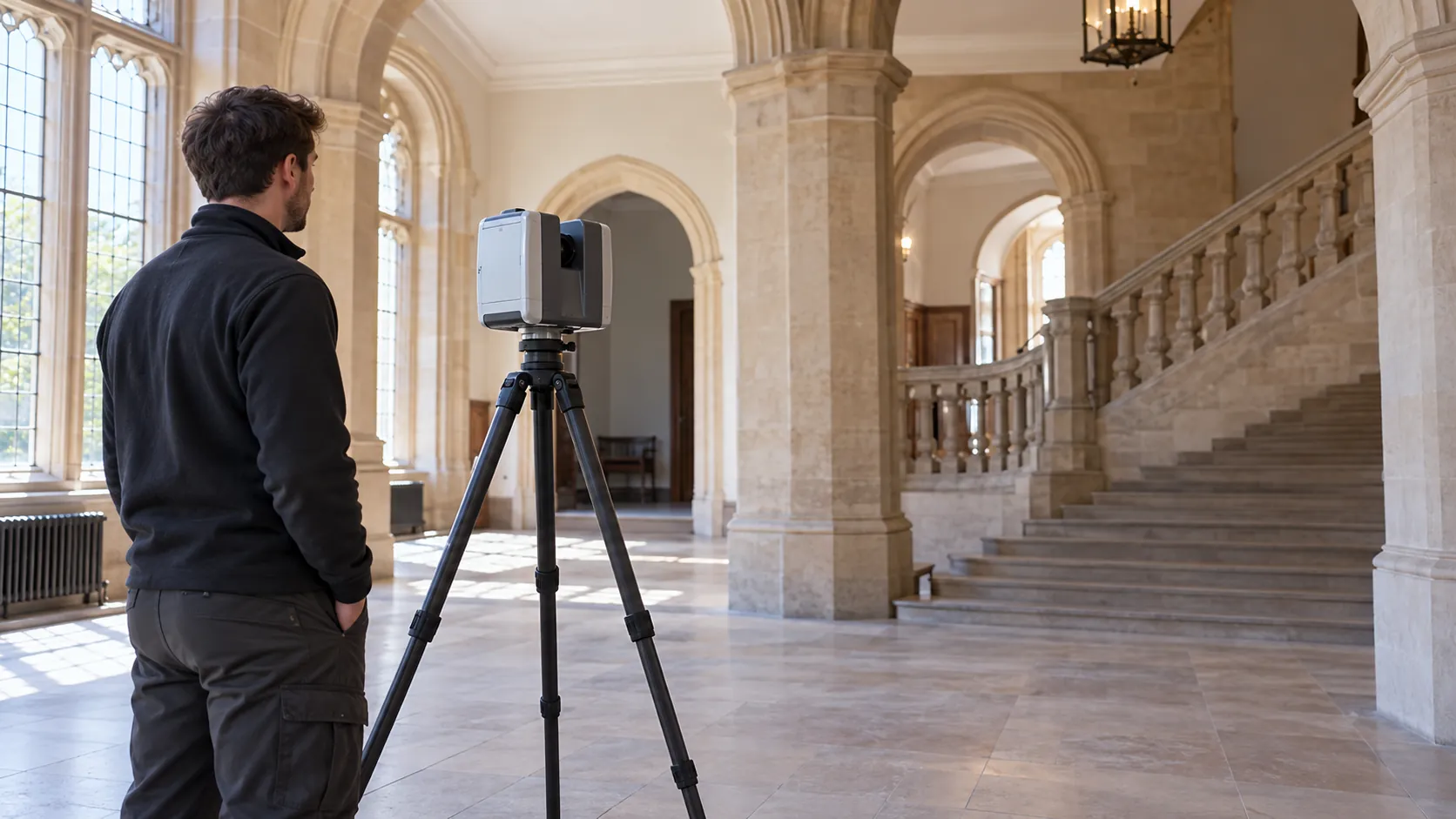
- Site Visit: Conduct a laser scan of the site using equipment such as a terrestrial laser scanner, which captures millions of precise points per second. This ensures we can measure complex environments with millimetre accuracy, an essential feature for clients in construction and architecture.
- Data Processing: Transform the raw data into detailed 3D models. We employ software like Leica Cyclone or Autodesk ReCap to register point clouds and create intricate representations, allowing for thorough analysis and visualisation of the structures scanned.
- Delivery: Provide the final models and reports to support your project. Our deliverables include not only the 3D models but also orthographic projections and measurements ensuring compatibility with industry standards like RICS, serving projects ranging from building renovations to infrastructure planning.
For a consultation on how our services can benefit your project, please get in touch.
Get a Free No Obligation Quotation Today
Who Does Laser Scanning Surveys Help?
We help a diverse range of clients, including architects, engineers, surveyors and construction firms. Our laser scanning technology is instrumental in capturing precise as-built data, which is crucial for planning renovations, performing alterations, and ensuring accurate construction management.
We work across various sectors, including commercial and historical buildings, where maintaining structural integrity and detailed records is essential.
For conservationists focused on heritage sites, our 3D laser scans provide accurate documentation without any physical intervention, preserving delicate features. Engineers rely on our services to generate reliable point cloud data that forms the basis for Building Information Modelling (BIM).
This ensures compatibility with industry-standard software like Revit and AutoCAD.
For surveyors, the detailed topographical maps we create facilitate better land-use planning and decision-making. By delivering precise measurements and comprehensive data, we help streamline project timelines and reduce costly rework.
Let us support your next project with our laser scanning solutions.
How Quickly Can Laser Scanning Surveys Respond?
At Laser Scanning Surveys, we understand the importance of timely data. Our team typically responds to inquiries within 24 hours, ensuring minimal delays in the initial stages of your project.
We can mobilise our 3D laser scanning equipment to your site within two to five working days, depending on factors such as project scope and location.
Whether it’s a complex urban development requiring detailed scanning or simpler topographical surveys for rural sites, we prioritise efficient scheduling to meet your needs. Our equipment, which includes high-precision laser scanners like the Leica RTC360, allows us to capture accurate data swiftly.
We adhere to industry standards such as BS 5606:1990, ensuring accuracy in every project.
Contact us today to discuss your specific requirements, and we will arrange the fastest possible deployment to your site.
How Does Laser Scanning Surveys Ensure Quality and Compliance?
We maintain high standards by using state-of-the-art laser technology and adhering to stringent industry regulations, such as those set by the Royal Institution of Chartered Surveyors (RICS) and ISO 9001:2015. Our team follows rigorous quality control procedures with equipment like the Leica RTC360 and Faro Focus, which provide millimetre-level accuracy.
We conduct regular calibration of our equipment to ensure consistency and reduce measurement errors, essential for precise site assessments.
The data we gather supports BIM (Building Information Modelling) applications and is suitable for projects requiring detailed topographical surveys, heritage documentation, and structural analysis. By maintaining comprehensive data logging and audit trails, we ensure that our surveys are not only accurate but also transparent and verifiable.
Our commitment to precision reassures clients in construction and architecture that they can depend on us to deliver superior insights for their projects.
Request a free quote
Why Choose Laser Scanning Surveys?
Choosing us for your laser scanning needs guarantees precision and reliability:
- Specialist Expertise: With years of experience in laser scanning services, our team is skilled in various survey types, including topographic and building surveys. We are proficient in using the latest Leica and FARO laser scanners, known for their accuracy and speed.
- Tech-Driven Approach: Our commitment to using advanced equipment and software, such as Autodesk ReCap and Trimble RealWorks, ensures detailed 3D models and point clouds, facilitating precise measurements and analysis.
- Customer-Focused: We offer tailored services to meet specific project requirements, whether for construction planning, heritage conservation, or facility management. Our flexible approach allows us to adapt to different project sizes and complexities.
- Comprehensive Support: We provide an end-to-end service from consultation to data delivery, ensuring seamless integration with BIM workflows and compliance with industry standards like RICS and ISO 19650.
Contact us today to discuss how our laser scanning solutions can benefit your projects.
Frequently Asked Questions
What is laser scanning?
Laser scanning is a method of capturing precise 3D measurements and data of structures and environments using laser technology. It produces detailed digital representations that aid in various planning and design processes.
How accurate are your laser scanning services?
Our laser scanning services deliver data with precision, generally within a few millimetres, ensuring the accuracy required for construction and design applications.
Can laser scanning be used in all environments?
Yes, laser scanning is versatile and can be adapted for use in various environments, including complex and historically significant structures.
What format are the survey results delivered in?
We typically deliver results in several digital formats compatible with CAD and BIM software, ensuring integration into your workflow.
How much does a laser scanning survey cost?
Costs depend on project size and complexity. Contact us to discuss your needs and get a quote.
Get a Free Quote
Ready to see how Laser Scanning Surveys can benefit your project? Contact us to request a free, no-obligation quote today.
speak with our team today
What People are Saying About Us
★★★★★
“A clear, detailed point cloud from Laser Scanning Surveys, delivered on time and exactly as promised.”
Kieran Patel
London
★★★★★
“The Laser Scanning Surveys team worked safely and tidily in our old building. Our architects started designing the conversion within days, straight from their scans.”
Oliver Duncan
London
★★★★★
“We needed our listed property scanned with care. Laser Scanning Surveys protected the floors and delivered neatly labelled floor plans and elevations, so nothing was left to guess.”
Jonathan Grant
London
★★★★★
“The Laser Scanning Surveys team were an absolute delight, so kind and capable. The scan results were wonderfully clear and I felt incredibly well looked after from start to finish!”
Priya Mackenzie
London
Our Locations
We are proud to work nationally across the UK, allowing us to ensure we can provide services to you.
For a full list of counties we cover in the UK, see below.